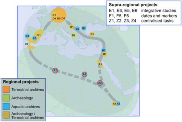
CRC 806 – Our Way to Europe: Late Quaternary high-resolution climate archives in the Sahara (project A2)
Summary
The Sahara was the inevitable passageway for any migration from tropical Africa to Europe during the Late Quaternary. In the first CRC phase (2009-2013), project A2 was able to obtain paleoclimatic and paleoenvironmental data sets from Lake Yoa, Chad, for the entire Holocene with unprecedented sensitivity and time-resolution data. In the second CRC phase, we are now intending to extend the data to the preceding late Pleistocene climatic cycle. Thereby, project A2 will continue to compile data from the Sahara that ultimately will provide a paleoclimatic standard for the CRC’s archaeological studies in northern Africa. This objective shall be approached by a regional extension of fieldwork at locations featuring pre-Holocene deposits in the Eastern, Central and Western Sahara, and their multi-proxy analysis.
(i) Jebel Ouenat, Northwest Sudan, Eastern Sahara (22°N / 24°E). A presumed impact crater on Jebel Ouenat, the highest mountain of the Eastern Sahara at the triple junction of Egypt, Libya and Sudan, is one of very few closed basins that are likely to contain late Pleistocene and Holocene sediments. Geophysical 4-point geoelectric methods will be employed to explore the basement morphology and sediment cover as a prerequisite for subsequent trenching and sampling in this remote and geologically yet unstudied location.
(ii) Gharb Depression, Northern Sudan, Eastern Sahara (18°30’-19°30’N / 30°15’E). Northern Sudan and its Nile corridor are the unavoidable prehistoric trajectories from Ethiopia to Egypt and beyond. The ~100 km long Gharb Depression, about 25 km west of the Nubian Nile, was used as a trans-Saharan route during the pre-dynastic period but also during the late Palaeolithic, as indicated by corresponding lithic artefacts. Geophysical transects through calcareous paleolakes and sebkhas applying transient electromagnetic exploration techniques will be conducted to determine sediment thicknesses for later trenching and to assist in the prospection for sub-surface Eemian (MIS 5) deposits for paleoclimatic and geoarchaeological analysis.
(iii) Erg Tihodaïne, Southeast Algeria, Central Sahara (25°20’N / 6°50’E). Late Pleistocene lacustrine deposits in the Tihodaïne dune field between the Hoggar and Tassili N’Ajjer provide the best alternative for the now inaccessible Wadi Shati in central Libya, which had been selected for the first period of the CRC 806. The exposed banks of limnites can tentatively be attributed to the early Holocene and the humid stages of MIS 5. Abundant Middle to Late Palaeolithic industries and remains of large vertebrates and even humans occur along the former lake shores. This exceptional lacustrine archive is most promising for the paleoclimatology and geoarchaeology of the period crucial to the CRC’s general topic in Africa.
(iv) Zemmur and Tiris, Western Sahara (21°-24°N / 12°-15°E). During previous fieldtrips and by ground-truth based satellite image interpretation, several playas (dry clay lakes) and sebkhas were singled out for the paleoenvironmental and paleoclimatic analysis of the Late Quaternary development of the presently hyper-arid to arid Zemmur and Tiris regions in the Western Sahara. Their stratigraphic and chronological study will aid in testing the supraregional validity of the Lake Yoa and the marine ODP 858 records, validate and foster numeric paleoclimate models, and possibly reveal pre-Holocene environmental evidence.
Project A2 in the second CRC phase (2013-2017) aims at carrying out fieldwork in (i), (ii), and, depending on accessibility and political conditions, either (iii) or (iv).